Просмотр новости
Найдите то, что Вас интересует
 Спутники
 РН
РН SpaceX
 Роскосмос
 NASA
NASA
СпутникиРНSpaceXРоскосмосNASA
The early weeks of the 2026 Atlantic hurricane season have provided the results one might expect in a season predicted to be dominated by El Niño and forecast to produce a below-average number of systems.
While that doesn’t mean that no storms form, the infrequency of areas to monitor is a refreshing change.
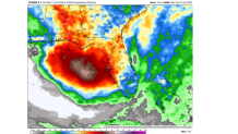
This week there is a new area to watch that encompasses the northeastern Gulf of Mexico and the southwestern Atlantic waters adjacent to Florida, Georgia and the Carolinas.
European model forecasts point towards meaningful rainfall whether a tropical system develops or not.
In the short term, the National Hurricane Center in Miami is not concerned about development chances. Their current outlook for the next 5 days holds development chances at zero percent.
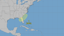
However, in the longer range, there is a small chance for development with probabilities of around 20%. By their standards this is a “low” chance classification, but here’s why it matters.
The National Hurricane Center in Miami is giving an area a 20% chance to develop over the next week.
Although chances are slim for tropical development, the set-up for something to percolate may be somewhat suitable as low pressure may develop along a fading frontal boundary. This is a common mode for “near shore” development adjacent to the United States.
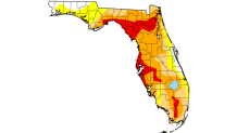
Whether or not development occurs, a welcome rain event could unfold for central and northern Florida, which remains entrenched in drought.
Much of Florida remains in drought following a very dry winter and an unusually slow start to the rainy
season.
It is too soon to know if this will simply be an area to monitor for a few days, or, if development will occur.
Per climatology, the second named system of the season usually comes mid-to-late July.
The season’s next name is “Bertha.” If it develops, this will follow June’s short-lived “Arthur” that brought heavy rainfall to Texas and Louisiana as a brief, low-end tropical storm.

This week there is a new area to watch that encompasses the northeastern Gulf of Mexico and the southwestern Atlantic waters adjacent to Florida, Georgia and the Carolinas.
The early weeks of the 2026 Atlantic hurricane season have provided the results one might expect in a season predicted to be dominated by El Niño and forecast to produce a below-average number of systems.
While that doesn’t mean that no storms form, the infrequency of areas to monitor is a refreshing change.
This week there is a new area to watch that encompasses the northeastern Gulf of Mexico and the southwestern Atlantic waters adjacent to Florida, Georgia and the Carolinas.
WeatherBell
European model forecasts point towards meaningful rainfall whether a tropical system develops or not.
In the short term, the National Hurricane Center in Miami is not concerned about development chances. Their current outlook for the next 5 days holds development chances at zero percent.
However, in the longer range, there is a small chance for development with probabilities of around 20%. By their standards this is a "low" chance classification, but here’s why it matters.
National Hurricane Center
The National Hurricane Center in Miami is giving an area a 20% chance to develop over the next week.
Although chances are slim for tropical development, the set-up for something to percolate may be somewhat suitable as low pressure may develop along a fading frontal boundary. This is a common mode for "near shore" development adjacent to the United States.
Whether or not development occurs, a welcome rain event could unfold for central and northern Florida, which remains entrenched in drought.
University of Nebraska – Lincoln
Much of Florida remains in drought following a very dry winter and an unusually slow start to the rainy season.
It is too soon to know if this will simply be an area to monitor for a few days, or, if development will occur.
The NBC 6 First Alert Weather team guides you through hurricane season

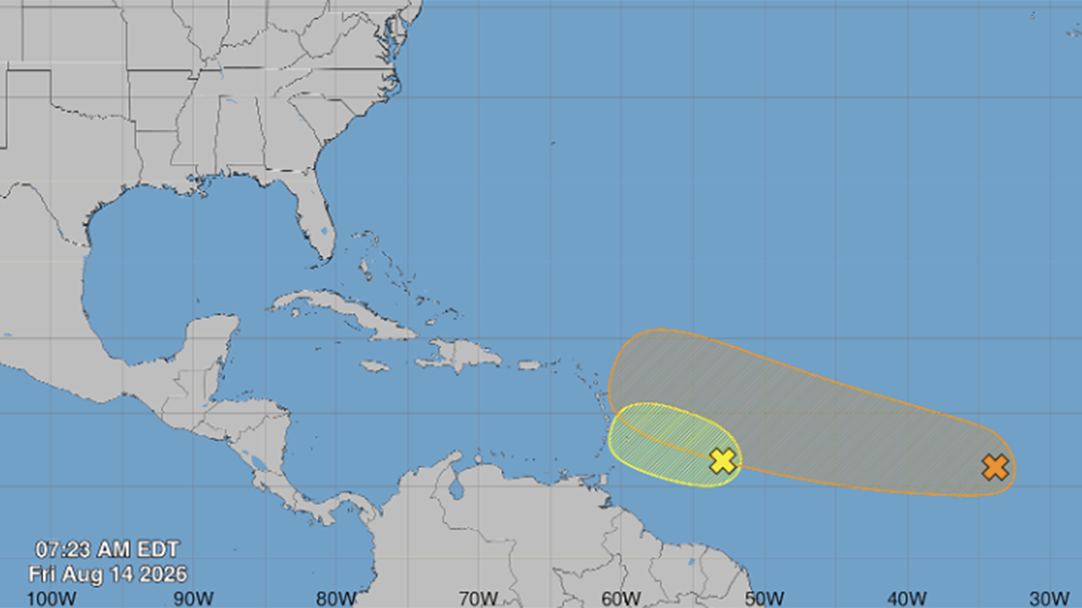
Per climatology, the second named system of the season usually comes mid-to-late July.
The season’s next name is "Bertha." If it develops, this will follow June’s short-lived "Arthur" that brought heavy rainfall to Texas and Louisiana as a brief, low-end tropical storm.
| # | Наименование новости | Тональность | Информативность | Дата публикации |
|---|---|---|---|---|
| 1 | National Hurricane Center focuses on Central Atlantic for possible development | 0 | 6.38 | 10-08-2026 |
| 2 | CSU's updated hurricane season forecast calls for fewer storms in 2026 | 0 | 19.02 | 10-06-2026 |
| 3 | Tropical Storm Cristobal forms, as forecasters eye 2 other potential systems | 0 | 16 | 12-08-2026 |
| 4 | NOAA reveals outlook for 2026 Atlantic hurricane season | 0 | 10.01 | 21-05-2026 |
| 5 | It's the start of hurricane season: What to expect | 0 | 15.23 | 01-06-2026 |
| 6 | El Niño locks in, with impacts to hurricane season and South Florida weather likely | 0 | 6.06 | 10-07-2026 |
| 7 | Atlantic hurricane season ramps up: What South Florida residents need to know | 0 | 7.3 | 09-08-2026 |
| 8 | Hurricane Season: July has produced impactful storms but 2026 won't support it | 0 | 6.38 | 07-07-2026 |
| 9 | National Hurricane Center to test a higher confidence forecast cone this season | 0 | 9.76 | 24-03-2026 |
| 10 | Hurricane Season 2026: NBC6's guide for South Florida residents | 0 | 11.9 | 01-06-2026 |