Просмотр новости
Найдите то, что Вас интересует
 Спутники
 РН
РН SpaceX
 Роскосмос
 NASA
NASA
СпутникиРНSpaceXРоскосмосNASA
The 2026 Atlantic Hurricane Season is upon us and if you aren’t already prepared, now is the time to do it.
The NBC6 First Alert Weather Team has developed a handy guide to help South Floridians get ready to weather any storm.
Click Here for NBC 6’s First Alert Weather 2026 Hurricane Guide
NBC6’s team of meteorologists has an unparalleled tool to monitor any threat that comes from the tropics, First Alert Live Doppler Radar. We are the only team with this tool, capturing instantaneous information that gives our forecasts a great sense of immediacy.
First Alert Live Doppler Radar monitors the skies in real-time from beyond central Florida, south to the Florida Keys, and even across portions of the Bahamas.
In the case of tropical systems, we will be able to clearly see inside of them, reaching the center of circulation or “eye.” We’ll know just how intense the rain is around them, how serious the potential for flooding is and calculate the degree of danger of the winds. All of which we can communicate immediately, to help keep you and your family safe through the season.
In this guide:
$(document).ready(function(){
function scrollToTargetAdjusted(which){
var element = document.getElementById(which);
var headerOffset = 100;
var elementPosition = element.getBoundingClientRect().top;
var offsetPosition = elementPosition + window.pageYOffset - headerOffset;
window.scrollTo({
top: offsetPosition,
behavior: "smooth"
});
}
$(".fastnav").click(function() {
//console.log($(this).attr("data-id"));
scrollToTargetAdjusted($(this).attr("data-id"));
});
});
Hurricane terminology
Important phone numbers
Supply kit
Staying safe
Storm names
Evacuations
Safguarding property
Emergency transport, shelter
Securing cars and boats
After the storm
.fastnav {white-space: nowrap;}
const bgDiv = document.querySelector('.hero-background');
const newContent = `
`;
bgDiv.innerHTML = newContent;
.hero-background {
background-image: url('https://media.nbcmiami.com/2025/05/hurricane-guide-2025-banner.jpg?quality=85&strip=all&w=1920');
background-color: #000;
background-position: center;
}
HURRICANE TERMINOLOGY
Tropical Cyclone: A low pressure system with origins over tropical or subtropical waters. Their organized deep convection around a closed surface wind circulation is maintained by the extraction of heat energy from the ocean.
Tropical Depression: Tropical low pressure system with maximum sustained winds of 38 mph or less. It can cause impactful amounts of precipitation that may lead to flooding.
Tropical Storm: Tropical low pressure system with maximum sustained winds of 39 to 73 mph. It may produce abundant rainfall, leading to flooding or localized damage. Powerful sustained winds, with higher gusts, can cause property damage.
Hurricane: Tropical low pressure system with maximum sustained winds of 74 mph or greater. This dangerous and multi-threat storm produces damaging winds and abundant rainfall. Storm surge potential varies by the size and forward speed of the hurricane, in addition to the angle at which it approaches the coastline.
Major Hurricane: A hurricane that is classified as a category 3 (sustained winds at 111 mph or higher). It can present exponentially higher possibilities of impacts of rain, wind and storm surge.
Tropical Storm Watch: An announcement that sustained winds of 39 to 73 mph are possible within the specified area within 48 hours in association with a tropical, subtropical, or post-tropical cyclone.
Tropical Storm Warning: An announcement that sustained winds of 39 to 73 mph are expected somewhere within the specified area within 36 hours in association with a tropical, subtropical, or post-tropical cyclone.
Rapid Intensification: An increase in the maximum sustained winds of a tropical cyclone of at least 30 kt (35 mph) in a 24 hour period.
Hurricane Watch: An announcement that sustained winds 74 mph or higher are possible within the specified area in association with a tropical, subtropical, or post-tropical cyclone. Because hurricane preparedness activities become difficult once winds reach tropical storm force, the hurricane watch is issued 48 hours in advance of the anticipated onset of tropical storm force winds.
Hurricane Warning: An announcement that sustained winds of 74 mph or higher are expected somewhere within the specified area in association with a with a tropical, subtropical, or post-tropical cyclone. Because hurricane preparedness activities become difficult once winds reach tropical storm force, the warning is issued 36 hours in advance of the anticipated onset of tropical-storm-force winds.
Storm Surge: An abnormal rise in sea level accompanying a hurricane or other intense storm, and whose height is the difference between the observed level of the sea surface and the level that would have occurred in the absence of the cyclone. Storm surge is usually estimated by subtracting the normal or astronomic high tide from the observed storm tide.
Tropical Wave: Also known as an easterly wave, this is an elongated area of relatively low pressure (trough) or cyclonic curvature maximum. They are found in the tropics, moving east to west, and can lead to the formation of a tropical cyclone.
Eye of the Storm: The roughly circular area of comparatively light winds that encompasses the center of a severe tropical cyclone. The eye is either completely or partially surrounded by the eyewall cloud.
Saffir-Simpson Scale: The Saffir-Simpson Hurricane Wind Scale is a 1 to 5 categorization based on a hurricane’s intensity at the indicated time. The scale provides examples of the type of damage and impacts in the United States associated with winds of the indicated intensity.
IMPORTANT PHONE NUMBERS
MIAMI-DADE COUNTY
American Red Cross305-644-1200Animal Control305-884-1101Emergency Management311 or 305-468-5400Public School Board305-995-1000Transit Service305-891-3131 || TTY: 305-499-8971Power Outages800-468-8243 || TTY: 711Water Management305-274-9272Solid Waste Management311 or 305-468-5900Humane Society305-696-0800Emergency Evacuation Assistance305-513-7700 || TTY: 305-468-5402
BROWARD COUNTY
American Red Cross954-797-3800Animal Control954-359-1313Emergency Management311 or 954-831-3900Public School Board754-321-0000Transit Service954-357-8400 || TTY: 954-357-8302Power Outages800-468-8243 || TTY: 711Water Management954-831-0751Solid Waste Management954-765-4999Humane Society954-989-3977Emergency Evacuation Assistance311 or 954-831-4000 || TTY: 954-831-3940
PALM BEACH COUNTY
American Red Cross561-833-7711Animal Care & Control561-233-1200Emergency Management561-712-6400 || TTY: 561-712-6342Public School Board561-434-8000Transit Service561-841-4270Power Outages561-697-8000Traffic Signal Repair561-684-4030PBC Water Utilities561-493-6000Solid Waste Authority561-697-2700Emergency Repairs 24 Hours561-822-2210Emergency Evacuation Assistance561-649-9848
MONROE COUNTY
American Red Cross305-644-1200Animal Control Key West305-294-4857Animal Control Marathon305-743-4800Animal Control Key Largo305-451-0088Emergency Management305-289-6018 || 800-955-5504Public School Board305-293-1400Transit Service305-292-4411Keys Energy305-295-1010Florida Keys Electric Co-Op305-852-2431Florida Keys Aqueduct Authority305-296-2454Solid Waste Management305-292-4432Humane Society (Upper Keys)305-451-3848Emergency Evacuation Assistance561-649-9848Emergency Evacuation Assistance305-292-4591Key West Information Hotline (Activated for Emergencies)305-809-1101
FEDERAL EMERGENCY MANAGEMENT AGENCY (FEMA)
1-800-621-FEMA (3362)
TTY: 1-800-462-7585
SUPPLY KIT CHECKLIST
Food and water
At least one gallon of water per person, per day for three to seven days
An additional gallon per day for cooking and personal use
Fill empty freezer space with gallons of water or water in freezer bags which you can also use as ice in a cooler if the power goes out
Water purification tablets
Non-perishable food items: canned meats, soups, fruits and vegetables
Powdered milk or individual drinks
Canned or boxed milk and fruit juices
Instant coffee and tea bags
Peanut butter, honey, jams and jellies
Granola, nuts, dried or fresh fruit
Bread, cereal, crackers and snacks
Special food for babies and the elderly
Paper plates and paper or plastic cups
Napkins and paper towels
Plastic eating utensils
Manual can and bottle openers
Health essentials
Fully stocked first-aid kit
Prescription Medications – minimum three-week supply
Vitamins
Antibacterial hand soap and hand sanitizer
Toilet paper, wipes, diapers
Insect repellant
Sunscreen (SPF 15 or higher)
Sanitary pads and other hygiene products
Face coverings/masks for every member of your family
Disposable gloves
Home
Battery powered portable television, AM/FM radio or crank powered radio
Battery powered flashlights or lanterns
Plenty of extra batteries
Fully charged mobile phones and portable electronics. Chargers and power banks
Grill with ready to light charcoal, Sterno or propane gas – use extreme caution when using these items
Plenty of matches or a waterproof lighter
Work gloves
Duct tape
Cleaning products (gallon of odorless bleach, garbage bags, etc.)
Extension cords for outdoor use, rope
Waterproof tarp for temporary roof repairs
Basic tool kit
Smoke and carbon monoxide detectors
Fire extinguisher
Cash on hand
Games and activities for children
Waterproof container or bag for important bank documents, social security, passports, property titles, etc.
Full tank of gas for your car
Pets
Documentation, license
Non-perishable food
Medications
Water
STAYING SAFE
Before
Review the emergency plan for your family or if there is no plan in place, create one.
Find out where the official evacuation shelters are located. Pre-register for special needs transportation or pet-friendly shelters, if applicable.
Write down the telephone numbers of family members in case of an emergency.
Review your insurance coverage.
Take inventory of important supplies and purchase whatever is needed.
Secure doors and install shutters with protective panels.
Fill your car’s gas tank. If you have a spare container, fill that as well.
Moor small boats or move them.
Secure chairs, tables and other outdoor and garden items or bring them inside.
Put your emergency plan into practice with your family members. Initiate protection measures, especially those requiring extra time, such as securing boats and evacuating to safer areas.
Frequently listen to official weather updates on NBC6, its associated radio stations or the station of the Oceanic and Atmospheric Administration (NOAA).
During
Remain calm.
Stay tuned to NBC6 for updated weather information.
Remain inside your home until the storm has passed. Do not confuse the eye of the storm with the storm being over. Listen to official weather updates to know when the storm has passed.
Disconnect circuit breakers before electrical power is cut off. Leave a single switch enabled with a lamp connected to it, to know when power has been restored.
Shelter in the safest room of your house and do not leave it, even if you hear the sound of breaking glass in another part of your home.
Keep your pets in their cages.
If your home begins to collapse around you, cover yourself and your family with a mattress. If you are in the bathroom, get in the tub and cover yourself with a mattress.
Only use your phone for urgent calls. Do not use it if it is thundering outside.
If you are in a high-rise building, avoid the upper floors. The wind speed on upper floors is much stronger. Go to a safe room and proceed with caution.
After
Do not go outside until officials say it is safe to do so.
If you remained in your home, inspect it for damage both inside and out.
Contact your insurance agent to report any losses.
If you evacuated, do not drive home until the roads are safe to do so.
Report any downed power lines and stay away from them.
Avoid standing water.
Obey all emergency orders.
Take extreme care while making emergency repairs and clearing up storm debris.
Be patient. A storm’s aftermath can be stressful for everyone.
TROPICAL CYCLONE NAMES FOR THE 2026 ATLANTIC SEASON
Arthur
Bertha
Cristóbal
Dolly
Edouard
Fay
Gonzalo
Hanna
Isaías
Josephine
Kyle
Leah
Marco
Nana
Omar
Paulette
René
Sally
Teddy
Vicky
Wilfred
PREPARING FOR EVACUATIONS
Flood/storm surge evacuation zones
In the event of a hurricane, it is vital to know if you live in a zone that would most likely be evacuated. If you do, it is recommended and encouraged that you stay with family or friends who live in an area deemed a non-evacuation zone. Evacuation shelters should be considered a place of last resort.
Visit these sites to learn more about evacuation zones in your area:
Miami-Dade: https://www.miamidade.gov/global/emergency/hurricane/storm-surge-zones.page
Broward: https://www.broward.org/Hurricane/Pages/Evacuations.aspx
Monroe: https://www.monroecounty-fl.gov/897/Evacuation-Information
Palm Beach: https://discover.pbcgov.org/publicsafety/dem/Pages/Know-Your-Zone.aspx
Seniors
Be sure to buy prescription medications in advance at authorized pharmaceutical stores.
If you must evacuate, don’t forget to take important items with you like prescription glasses, hearing aids with extra batteries, canes, walkers, inhalers, etc.
Pets
When making plans, we must also consider pets. Pet friendly county shelters do exist, but you will need to do your homework beforehand to find out where they are located and what their rules are. Pre-registration is required for most, if not all of them.
Be sure to have your pet’s medical records and microchip information with you. Make sure their vaccines are up to date and that they are registered with the county you live in.
Your pet must wear a secure collar with their current identification at all times.
Prepare and bring a pet survival kit, a waterproof container that includes things like a minimum three-day supply of food and water, serving bowls, a towel, blanket, accessories and toys, carrier or crate, leash and muzzle (if needed).
Remember, county shelters aren’t boarding facilities. You must remain at the facility to care for your pet at all times.
People with disabilities
If you have special needs, don’t wait for a storm. Plan to make arrangements at the start of hurricane season. You can get more information and pre-register using one of the links below:
Miami-Dade County: https://www.miamidade.gov/global/service.page?Mduid_service=ser1470238193996672
Broward County: https://www.broward.org/Registry/Pages/default.aspx
Monroe County: https://www.monroecountyem.com/148/Special-Needs-Registry
Palm Beach County: https://discover.pbcgov.org/publicsafety/dem/pages/special-needs.aspx
SAFEGUARDING YOUR HOME AND PROPERTY
Preparing for power outages
In an emergency only use flashlights or battery powered lanterns as light sources, DO NOT use candles.
Disconnect any electrical equipment you were using when the power was interrupted.
Avoid opening the refrigerator and freezer.
If you use a computer, keep backup copies of your files and operating systems.
Consider purchasing replacement batteries and a power converter if you use a laptop.
If your garage door is electric, be sure you know how to operate it manually.
Safety when using generators
Purchase a generator that is registered with the Underwriters Laboratory (UL) or Factory Mutual (FM).
If you use a generator, connect the equipment directly to the generator outputs. Do not connect the generator to the electrical system of the house.
Do not use a generator inside the house or inside the garage.
Make sure the generator is cool before refueling.
Protecting your possessions (insurance)
If you live in a hurricane-prone area or in an interior area where there may be heavy rains from a hurricane, take the necessary steps now to protect your property from water damage. This includes the purchase of insurance.
Home insurance in general does not cover floods. It is important that you get protection against the floods associated with hurricanes, tropical storms. heavy rains and other conditions that affect the US.
Find out about the National Flood Insurance Program at www.FloodSmart.gov. A policy purchased today will take effect within 30 days, so act now.
EMERGENCY TRANSPORTATION & SHELTER
Emergency transportation
All counties will have emergency evacuation bus pick-up sites. The buses placed into service for evacuation will only travel between emergency evacuation bus pick-up sites and evacuation centers.
Residents who don’t have their own means for transportation can use public transportation if a designated emergency evacuation bus pick-up site is not located nearby.
For more information about emergency shelters open during the storm stay tuned to NBC6 or visit the websites below:
Miami-Dade County: https://www.miamidade.gov/global/service.page?Mduid_service=ser1477583540306215
Broward County: https://www.broward.org/BCT/Resources/Pages/Emergency.aspx
Monroe County: https://www.monroecounty-fl.gov/897/Evacuation-Information
Palm Beach County: https://www.palmtran.org/hurricane-updates/
Emergency shelters
Miami-Dade, Broward, Palm Beach and Monroe counties encourage residents that live in evacuation areas to look for a secure place to stay during the storm. For those who can’t find a secure place with friends or family, the American Red Cross will provide shelters in Miami-Dade and Broward and should be considered a last resort place of refuge. In Monroe County, shelters will only open for category 1 and 2 storms.
Remember that not all shelters will open. The latest information can be found via local media outlets or by contacting the County’s Office of Emergency Management.
Miami Dade County: https://www.miamidade.gov/global/emergency/activation/home.page
Broward County: https://www.broward.org/Hurricane/pages/shelters.aspx
Monroe County: http://www.monroecountyem.com/992/Shelters
Palm Beach County: https://discover.pbcgov.org/publicsafety/dem/Pages/Hurricane.aspx#_SSG
SECURING CARS & BOATS
Cars
Keep your vehicle inside your garage.
If you do not have a garage, park your car near your home or a building to protect it from the wind.
Do not park in narrow areas between two buildings. Winds can intensify through these spaces.
Remove all exterior attachments from your vehicles (antennas, magnets, etc.).
Park your car away from trees and power lines.
Boats on land
If you have a small boat (less than 20 feet) at home or in storage, keep it flipped and as close to a wall as possible; or keep it on a trailer.
If you don’t have a trailer, tie the boat securely with heavy rope and attach the rope to sturdy ground anchors or to a large tree.
Remove boat equipment, motors and accessories and store them indoors.
If you keep your boat in the marina, make sure the rental agreement explains who is responsible for the boat during the storm.
If you have a large boat (more than 20 feet) you must keep it in a trailer in the garage.
If you leave it out remove all equipment and accessories, strap it to its trailer and cover it. If possible, secure the trailer to a solid foundation and let out at least half of the air in the tires.
Boats in water
Do not tie the boat to the dock when the storm is nearing.
The boat should be at least 12 to 15 feet away from the dock, anchored from the bow and stern in deep water.
Remember to leave enough slack to your weighted lines to allow for an approximately five-foot rise in the tide.
Remove all water sensitive equipment and store in watertight containers. Make sure you store all important documents related to the boat in a safe place.
Clean all cabin drains and tie down everything that cannot be removed.
Make sure your boat has sufficient fuel and that your bilge pumps work.
Check your lease or storage rental agreement with marina or storage management and familiarize yourself with your responsibilities and liabilities, as well as those of the marina or storage facility.
If tying up your boat in a canal, get permission from affected property owners. Remember to keep the boat away from the docks using spring lines.
You can also tie your boat to a large living tree, so long as it has deep roots.
STAYING SAFE AFTER THE STORM
If your home has suffered major damage, do not go inside until an official inspection says you can.
Locate your fire extinguisher before turning on your home’s electric breakers.
Stay away from downed power lines and any puddles near them. Report any downed or sparking electrical lines and any damaged gas or water pipes.
Do not accumulate debris near power lines.
Avoid driving your vehicles as roads will be unsafe. Streets may be flooded. Debris, downed power lines and trees may block some roads.
Call your out-of-state contact and let them know you are well.
Do not drink tap water until the authorities say it is safe to do so.
Inspect your home to assess the damage. Take photographs of damaged areas and goods.
Cut fallen tree branches into pieces that are four feet or less. Place debris in sealed plastic bags that can hold up to fifty pounds of weight.
This story uses functionality that may not work in our app. Click here to open the story in your web browser.
The 2026 Atlantic Hurricane Season is upon us and if you aren't already prepared, now is the time to do it.
The NBC6 First Alert Weather Team has developed a handy guide to help South Floridians get ready to weather any storm.
Click Here for NBC 6's First Alert Weather 2026 Hurricane Guide
NBC6’s team of meteorologists has an unparalleled tool to monitor any threat that comes from the tropics, First Alert Live Doppler Radar. We are the only team with this tool, capturing instantaneous information that gives our forecasts a great sense of immediacy.
First Alert Live Doppler Radar monitors the skies in real-time from beyond central Florida, south to the Florida Keys, and even across portions of the Bahamas.
In the case of tropical systems, we will be able to clearly see inside of them, reaching the center of circulation or “eye.” We’ll know just how intense the rain is around them, how serious the potential for flooding is and calculate the degree of danger of the winds. All of which we can communicate immediately, to help keep you and your family safe through the season.
In this guide:
HURRICANE TERMINOLOGYTropical Cyclone: A low pressure system with origins over tropical or subtropical waters. Their organized deep convection around a closed surface wind circulation is maintained by the extraction of heat energy from the ocean.
Tropical Depression: Tropical low pressure system with maximum sustained winds of 38 mph or less. It can cause impactful amounts of precipitation that may lead to flooding.
Tropical Storm: Tropical low pressure system with maximum sustained winds of 39 to 73 mph. It may produce abundant rainfall, leading to flooding or localized damage. Powerful sustained winds, with higher gusts, can cause property damage.
Hurricane: Tropical low pressure system with maximum sustained winds of 74 mph or greater. This dangerous and multi-threat storm produces damaging winds and abundant rainfall. Storm surge potential varies by the size and forward speed of the hurricane, in addition to the angle at which it approaches the coastline.
Major Hurricane: A hurricane that is classified as a category 3 (sustained winds at 111 mph or higher). It can present exponentially higher possibilities of impacts of rain, wind and storm surge.
Tropical Storm Watch: An announcement that sustained winds of 39 to 73 mph are possible within the specified area within 48 hours in association with a tropical, subtropical, or post-tropical cyclone.
Tropical Storm Warning: An announcement that sustained winds of 39 to 73 mph are expected somewhere within the specified area within 36 hours in association with a tropical, subtropical, or post-tropical cyclone.
Rapid Intensification: An increase in the maximum sustained winds of a tropical cyclone of at least 30 kt (35 mph) in a 24 hour period.
Hurricane Watch: An announcement that sustained winds 74 mph or higher are possible within the specified area in association with a tropical, subtropical, or post-tropical cyclone. Because hurricane preparedness activities become difficult once winds reach tropical storm force, the hurricane watch is issued 48 hours in advance of the anticipated onset of tropical storm force winds.
Hurricane Warning: An announcement that sustained winds of 74 mph or higher are expected somewhere within the specified area in association with a with a tropical, subtropical, or post-tropical cyclone. Because hurricane preparedness activities become difficult once winds reach tropical storm force, the warning is issued 36 hours in advance of the anticipated onset of tropical-storm-force winds.
Storm Surge: An abnormal rise in sea level accompanying a hurricane or other intense storm, and whose height is the difference between the observed level of the sea surface and the level that would have occurred in the absence of the cyclone. Storm surge is usually estimated by subtracting the normal or astronomic high tide from the observed storm tide.
Tropical Wave: Also known as an easterly wave, this is an elongated area of relatively low pressure (trough) or cyclonic curvature maximum. They are found in the tropics, moving east to west, and can lead to the formation of a tropical cyclone.
Eye of the Storm: The roughly circular area of comparatively light winds that encompasses the center of a severe tropical cyclone. The eye is either completely or partially surrounded by the eyewall cloud.
Saffir-Simpson Scale: The Saffir-Simpson Hurricane Wind Scale is a 1 to 5 categorization based on a hurricane's intensity at the indicated time. The scale provides examples of the type of damage and impacts in the United States associated with winds of the indicated intensity.
IMPORTANT PHONE NUMBERSMIAMI-DADE COUNTY
| American Red Cross | 305-644-1200 |
| Animal Control | 305-884-1101 |
| Emergency Management | 311 or 305-468-5400 |
| Public School Board | 305-995-1000 |
| Transit Service | 305-891-3131 || TTY: 305-499-8971 |
| Power Outages | 800-468-8243 || TTY: 711 |
| Water Management | 305-274-9272 |
| Solid Waste Management | 311 or 305-468-5900 |
| Humane Society | 305-696-0800 |
| Emergency Evacuation Assistance | 305-513-7700 || TTY: 305-468-5402 |
BROWARD COUNTY
| American Red Cross | 954-797-3800 |
| Animal Control | 954-359-1313 |
| Emergency Management | 311 or 954-831-3900 |
| Public School Board | 754-321-0000 |
| Transit Service | 954-357-8400 || TTY: 954-357-8302 |
| Power Outages | 800-468-8243 || TTY: 711 |
| Water Management | 954-831-0751 |
| Solid Waste Management | 954-765-4999 |
| Humane Society | 954-989-3977 |
| Emergency Evacuation Assistance | 311 or 954-831-4000 || TTY: 954-831-3940 |
PALM BEACH COUNTY
| American Red Cross | 561-833-7711 |
| Animal Care & Control | 561-233-1200 |
| Emergency Management | 561-712-6400 || TTY: 561-712-6342 |
| Public School Board | 561-434-8000 |
| Transit Service | 561-841-4270 |
| Power Outages | 561-697-8000 |
| Traffic Signal Repair | 561-684-4030 |
| PBC Water Utilities | 561-493-6000 |
| Solid Waste Authority | 561-697-2700 |
| Emergency Repairs 24 Hours | 561-822-2210 |
| Emergency Evacuation Assistance | 561-649-9848 |
MONROE COUNTY
| American Red Cross | 305-644-1200 |
| Animal Control Key West | 305-294-4857 |
| Animal Control Marathon | 305-743-4800 |
| Animal Control Key Largo | 305-451-0088 |
| Emergency Management | 305-289-6018 || 800-955-5504 |
| Public School Board | 305-293-1400 |
| Transit Service | 305-292-4411 |
| Keys Energy | 305-295-1010 |
| Florida Keys Electric Co-Op | 305-852-2431 |
| Florida Keys Aqueduct Authority | 305-296-2454 |
| Solid Waste Management | 305-292-4432 |
| Humane Society (Upper Keys) | 305-451-3848 |
| Emergency Evacuation Assistance | 561-649-9848 |
| Emergency Evacuation Assistance | 305-292-4591 |
| Key West Information Hotline (Activated for Emergencies) | 305-809-1101 |
FEDERAL EMERGENCY MANAGEMENT AGENCY (FEMA)
1-800-621-FEMA (3362)
TTY: 1-800-462-7585
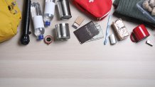
Food and water
Health essentials
Home
Pets
Before
During
After
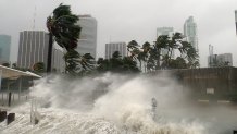
Flood/storm surge evacuation zones
In the event of a hurricane, it is vital to know if you live in a zone that would most likely be evacuated. If you do, it is recommended and encouraged that you stay with family or friends who live in an area deemed a non-evacuation zone. Evacuation shelters should be considered a place of last resort.
Visit these sites to learn more about evacuation zones in your area:
Miami-Dade: https://www.miamidade.gov/global/emergency/hurricane/storm-surge-zones.page
Broward: https://www.broward.org/Hurricane/Pages/Evacuations.aspx
Monroe: https://www.monroecounty-fl.gov/897/Evacuation-Information
Palm Beach: https://discover.pbcgov.org/publicsafety/dem/Pages/Know-Your-Zone.aspx
Seniors
Be sure to buy prescription medications in advance at authorized pharmaceutical stores.
If you must evacuate, don’t forget to take important items with you like prescription glasses, hearing aids with extra batteries, canes, walkers, inhalers, etc.
Pets
When making plans, we must also consider pets. Pet friendly county shelters do exist, but you will need to do your homework beforehand to find out where they are located and what their rules are. Pre-registration is required for most, if not all of them.
People with disabilities
If you have special needs, don’t wait for a storm. Plan to make arrangements at the start of hurricane season. You can get more information and pre-register using one of the links below:
Miami-Dade County: https://www.miamidade.gov/global/service.page?Mduid_service=ser1470238193996672
Broward County: https://www.broward.org/Registry/Pages/default.aspx
Monroe County: https://www.monroecountyem.com/148/Special-Needs-Registry
Palm Beach County: https://discover.pbcgov.org/publicsafety/dem/pages/special-needs.aspx
SAFEGUARDING YOUR HOME AND PROPERTYPreparing for power outages
Safety when using generators
Protecting your possessions (insurance)
If you live in a hurricane-prone area or in an interior area where there may be heavy rains from a hurricane, take the necessary steps now to protect your property from water damage. This includes the purchase of insurance.
Home insurance in general does not cover floods. It is important that you get protection against the floods associated with hurricanes, tropical storms. heavy rains and other conditions that affect the US.
Find out about the National Flood Insurance Program at www.FloodSmart.gov. A policy purchased today will take effect within 30 days, so act now.
EMERGENCY TRANSPORTATION & SHELTEREmergency transportation
All counties will have emergency evacuation bus pick-up sites. The buses placed into service for evacuation will only travel between emergency evacuation bus pick-up sites and evacuation centers.
Residents who don't have their own means for transportation can use public transportation if a designated emergency evacuation bus pick-up site is not located nearby.
For more information about emergency shelters open during the storm stay tuned to NBC6 or visit the websites below:
Miami-Dade County: https://www.miamidade.gov/global/service.page?Mduid_service=ser1477583540306215
Broward County: https://www.broward.org/BCT/Resources/Pages/Emergency.aspx
Monroe County: https://www.monroecounty-fl.gov/897/Evacuation-Information
Palm Beach County: https://www.palmtran.org/hurricane-updates/
Emergency shelters
Miami-Dade, Broward, Palm Beach and Monroe counties encourage residents that live in evacuation areas to look for a secure place to stay during the storm. For those who can't find a secure place with friends or family, the American Red Cross will provide shelters in Miami-Dade and Broward and should be considered a last resort place of refuge. In Monroe County, shelters will only open for category 1 and 2 storms.
Remember that not all shelters will open. The latest information can be found via local media outlets or by contacting the County's Office of Emergency Management.
Miami Dade County: https://www.miamidade.gov/global/emergency/activation/home.page
Broward County: https://www.broward.org/Hurricane/pages/shelters.aspx
Monroe County: http://www.monroecountyem.com/992/Shelters
Palm Beach County: https://discover.pbcgov.org/publicsafety/dem/Pages/Hurricane.aspx#_SSG
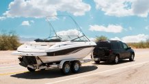
Cars
Boats on land
Boats in water
From a power plan to knowing evacuation zones, NBC6's First Alert Weather team explains how to stay safe during the 2026 Atlantic Hurricane Season.
| # | Наименование новости | Тональность | Информативность | Дата публикации |
|---|---|---|---|---|
| 1 | It's the start of hurricane season: What to expect | 0 | 15.23 | 01-06-2026 |
| 2 | Atlantic hurricane season ramps up: What South Florida residents need to know | 0 | 7.3 | 09-08-2026 |
| 3 | National Hurricane Center focuses on Central Atlantic for possible development | 0 | 6.38 | 10-08-2026 |
| 4 | CSU's updated hurricane season forecast calls for fewer storms in 2026 | 0 | 19.02 | 10-06-2026 |
| 5 | Hurricane Season: July has produced impactful storms but 2026 won't support it | 0 | 6.38 | 07-07-2026 |
| 6 | Forecasters watching potential tropical system in the Gulf | 0 | 10.87 | 15-07-2026 |
| 7 | National Hurricane Center to test a higher confidence forecast cone this season | 0 | 9.76 | 24-03-2026 |
| 8 | Tropical Storm Cristobal forms, as forecasters eye 2 other potential systems | 0 | 16 | 12-08-2026 |
| 9 | John Morales: Forecast shows fewer hurricanes during 2026 season, but don't get comfortable | 0 | 8.24 | 31-05-2026 |
| 10 | El Niño locks in, with impacts to hurricane season and South Florida weather likely | 0 | 6.06 | 10-07-2026 |